Take Our Self-Guided Watershed Bike Tour and Visit Some Great Water Quality Projects

- Share on:
-

-

-

-

-

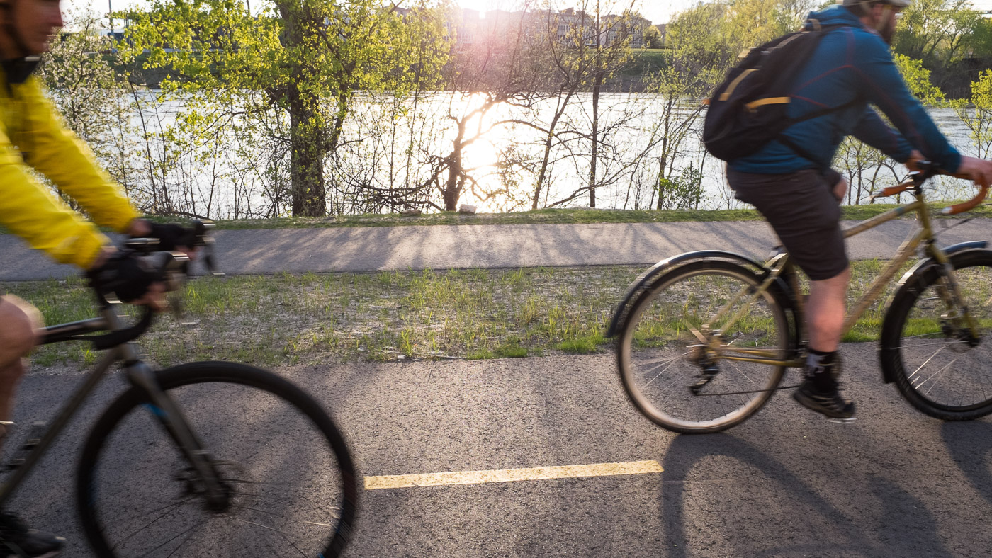
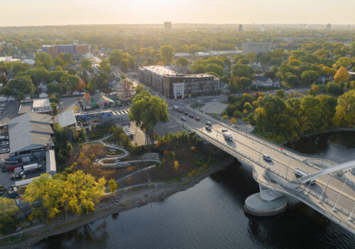
With so many activities and summer traditions canceled this summer, many of us are left looking for new things to do and ways to be outside. The Twin Cities are well recognized for having great bicycle infrastructure and many people enjoy getting out and pedaling around. With that in mind, we have created a virtual bike tour of the watershed. So, pump up your tires, grab your helmet and a water bottle, and go on a self-guided journey to learn more about water quality and habitat protection in our watershed.
With so many things to do and see on a bike ride around the watershed, we chose a few different projects to highlight that were easily connected by bike paths and dedicated bike lanes. Each of these projects demonstrates one or many of the ways that we partner with other government units, nonprofits and community groups to manage stormwater, restore habitat and protect water quality in the Mississippi River. We’ve put together an interactive map of the tour as well as a video and background info for each site.
How to Use the Virtual Bike Tour
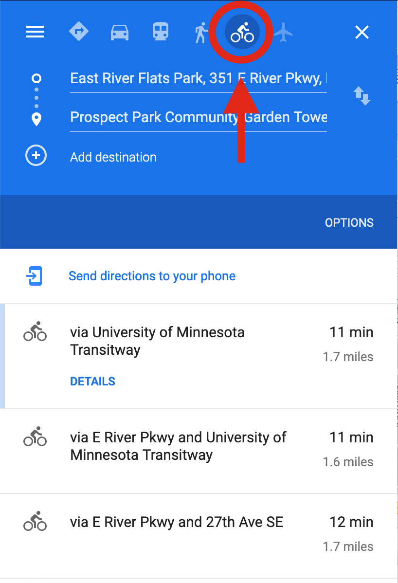
There are a few different ways that you can participate in this virtual bike tour. If you’re bringing your smartphone or another mobile device with you, your best bet is to open this blog post on your phone and cue up the video at each site. You can also use the links below each video to get directions to each of the five stops via Google Maps. (Be sure to take advantage of Google’s bicycle-friendly route planning feature.)
At each stop, you can follow along as an MWMO staff person points out project highlights and provides background information in the video. All of our tour stops are on public land and you are free to explore and take your time in each location. Once you are ready to move on, check your map and head out to the next stop and repeat.
Alternatively, you could watch the videos for each stop before you head out on your bike and get a little bit of background before you go. Or, if you don’t want to bike at all, you can watch the videos in their entirety and just be along for the virtual ride. (There’s a full video playlist, including a brief introduction, at the bottom of this page.)
Need a bike? Since this entire bike tour takes place within the city limits of Minneapolis, you can check out and return a bike at NiceRide stations all along the route. Find out more about NiceRide and locate a convenient station here.
Stop #1: Hall’s Island and Graco Park
Get Directions to Hall’s Island on Google Maps
Graco Park (formerly known as Scherer Park) is where we start the bike tour. On the east bank of the river, just north of the Plymouth Avenue bridge, walk from the bike trail across the grass toward the beach where you will see Hall’s Island. If you need it, there is free parking along the street on Sibley Street NE or paid parking at Boom Island Park, just across Plymouth Avenue.
From the beach at Graco Park, you can see a brand-new island in the Mississippi River. The island was reconstructed in 2018 after having been destroyed by industrial development in the 1960s. Led by the Minneapolis Park and Recreation Board, this project focused on restoring the island to support native vegetation and provide habitat for wildlife in the river corridor. Watch a video about the island construction and find out more about the Hall’s Island project here.
The Hall’s Island project is one of the first projects to be implemented as part of the RiverFirst initiative, a plan to redevelop an 11-mile stretch of the Mississippi River waterfront from the northern edge of Minneapolis to downtown by creating a network of trails and parks that connect people with the river, protect water quality and provide habitat for native plants and wildlife.
Stop #2: Nicollet Island Restoration and Bank Stabilization
Get Directions to Nicollet Island on Google Maps
From Graco Park/Hall’s Island, cross Plymouth Avenue and hop on the bike trail and ride south through Boom Island Park and cross the old railroad bridge to Nicollet Island. Note that there is a small section of gravel once you get to the island, so if you have very skinny tires you may need to walk your bike for a few minutes until the pavement begins again. Bike around the quiet streets of the island as you like and if you want to find the spot where our video segment was filmed, bike along East Island Avenue, toward the northern end of the island.
From 2017-2019, MWMO provided funding for restoration work on Nicollet Island. Our partner organization, Friends of the Mississippi River led the project and engaged a group of community partners in removing invasive species and planting native plants to restore more than 7 acres of open space on the island. Not only did diversifying and restoring the vegetation provide a healthier ecosystem, but it also stabilized the banks of the island and reduced erosion, helping to protecting water quality in the river.
At this stop you will learn more about the work that was done on Nicollet Island and see how it looks a year after the project was completed. Find out more about the Nicollet Island project on our website.
Stop #3: Towerside Stormwater Park
Get Directions to Towerside on Google Maps
On your way from Nicollet Island to Towerside, you will ride the old brick streets of St. Anthony Main (note: this will be a bit bumpy), pass through the University of Minnesota Campus and experience the smooth surface of the Dinkytown Greenway as you snake around behind the sports stadiums toward the old storage towers that lie east of the campus.
Towerside is a 370-acre business and residential district located along the transit corridor between the downtowns of St. Paul and Minneapolis and adjacent to the University of Minnesota. This mixed-use neighborhood has sprung up in the last decade and occupies space previously used for industrial purposes. The Towerside Innovation District was developed to intentionally bring together many layers of urban life and strives to be a model of environmentally-minded, sustainable urban redevelopment.
The MWMO collaborated with a network of private and public partners at Towerside to build a district system to manage stormwater — an innovative approach to stormwater management in which stormwater from multiple properties is managed together instead of separately. In this case, four adjacent properties voluntarily agreed to share their stormwater in a system that is highly sustainable, resilient and cost-efficient.
At this stop, you can see how stormwater runoff is directed from each of four properties toward a large stormwater park — a beautiful green space among the high-rise buildings surrounding it. A large tank buried under the park stores the captured runoff where it is available for reuse by each of the contributing properties as well as the adjacent park and community garden space. This system keeps huge amounts of water out of the stormwater system, provides habitat for wildlife and open space for neighbors.
Watch a video detailing the planning and implementation of the district system and get more information on our website.
Stop #4: East River Flats Park Rain garden
Get Directions to East River Flats Park on Google Maps
From Towerside, you will head past the University of Minnesota Medical Center and over to East River Parkway. As you ride down the hill into East River Flats Park, you can see the river and a smattering of picnic tables and trails for meandering the riverbank and relaxing. Continue through the parking lot toward the University of Minnesota Rowing Club’s Boat House. On the north side of the boat house, there is a large rain garden. This is our destination.
In 2018, Master Water Steward Mary Hammes, who spends a lot of time in the park, approached the MWMO about a persistent issue of standing water on the turf next to the boat house. Her Master Water Steward training helped her recognize that this standing water problem could be managed, and she was given a grant through the MWMO’s Master Water Stewards grant program to build a rain garden at that location.
Working closely with Metro Blooms and a large crew of volunteers, Hammes led the effort to install a rain garden at that site, which collects and infiltrates the runoff from the roof of the boat house as well as overland flow from the surrounding turf. Deep rooted native plants help create pathways in the soil and pull the water down, removing pollutants along the way. By removing pollutants and intercepting stormwater before it gets to the river, this rain garden plays a significant role in protecting water quality while also providing habitat for insects and birds at East River Flats Park.
This rain garden is a great example of a community-driven green infrastructure project. MWMO works hard to partner with and empower those who live, work and play in the watershed to take action to protect water quality and habitat.
Stop #5: Water Works
Get Directions to Water Works on Google Maps
From the University of Minnesota Campus, you will cross the river and ride past Gold Medal Park, the Guthrie and the Stone Arch Bridge. Just beyond the bridge, you will see the construction zone for the new Water Works site (part of Mill Ruins Park).
Our only stop on the west side of the river, the Water Works project has been under construction for the past two summers, and it’s exciting to see the new park begin to take shape. Like the first stop at Hall’s Island, this project is part of the Minneapolis Park and Recreation Board’s RiverFirst Initiative. When completed, Water Works will create new riverfront access by developing a pathway and green space between the bustling streets of Downtown Minneapolis and the river.
The first phase of construction for this park is slated to be finished by fall of 2020. In this phase, a section of land between 1st Street South and West River Parkway was cleared and old mill ruins excavated. A new path, stairs, green space and a park pavilion are all currently under construction.
The MWMO funded a stormwater reuse system for the project, which takes roof runoff from buildings adjacent to the site and collects it in large tanks underground. The captured water will then be reused for flushing toilets in the new park pavilion and irrigating new plants on the site. Stormwater reuse like this is a great way to save water, since it displaces some of the potable water that would be used for these purposes. It also keeps all of that stormwater runoff out of the river and all of the pollutants that stormwater typically carries with it.
After finishing the first phase of park development this fall, the Park Board plans to begin phase II in 2021. Learn more about Waterworks here.
Conclusion
That concludes our virtual bike tour of the watershed! If you parked a car near Graco Park or Boom Island, continue north on West River Parkway to the Plymouth Avenue bridge and cross the bridge to where you started. Otherwise, you can find you way to your next destination on your own.
We hope that you had a safe and enjoyable bike ride and learned a little about watershed management along the way. Let us know how you liked it and if you would like to see more of these in the future.
Map
Here’s our interactive map of the bike tour. Click on a pin to see information and a video on each project.
Full Video Playlist
You can view all of the above videos from start to finish, together with a short introduction, as a single playlist below. Enjoy!
(Top photo: Lucas Winzenburg)
- Share on:
-
-
-
-
-