Watershed Modeling
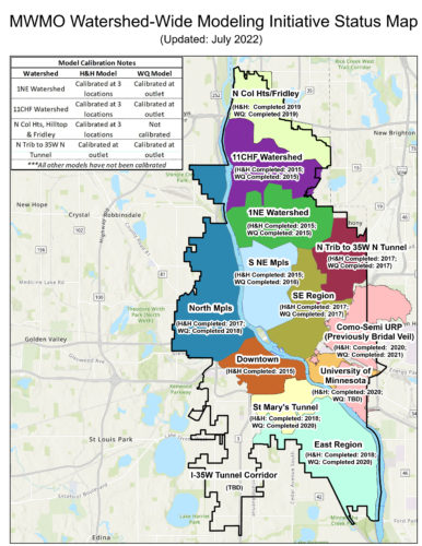
The MWMO is in the process of developing comprehensive models for all of the subwatersheds within its boundaries. Using these models, the MWMO and its partners are able to predict flood risk to properties throughout the watershed, as well as the amount of pollution entering the Mississippi River following rainfall events. These models will be used to help identify the most effective locations in the watershed to implement both flood control and water quality improvement projects.
For each subwatershed, two models are being developed. A hydrology and hydraulics (H&H) model is created to understand the volume and rate of stormwater flow during rainfall events, as well as inform watershed planning related to mitigating flood risk. A water quality model is then developed to understand the amount and sources of pollution being generated and flowing through the storm sewer system to the Mississippi River.
To help ensure accuracy and provide additional certainty for decision-makers, the modeling results are compared and calibrated to actual MWMO monitoring data, real-life information on how water and pollutants are moving through the stormwater system.
MWMO Watershed Modeling Status Map (PDF, 3 MB, 1 page)
Last Updated: July 2022
Contact
Nancy Stowe
Projects and Outreach Director
612-746-4978
Email Nancy Stowe
View Bio