Fighting erosion and restoring shoreline at Riverfront Regional Park
- Share on:
-

-

-

-

-

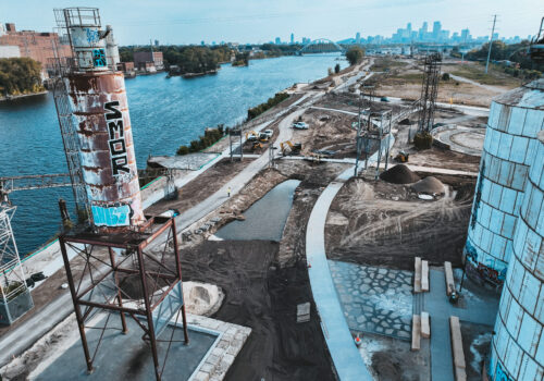
We are fortunate to have an abundance of parkland along the Mississippi River as it runs through our watershed. These parks are great places to visit, but they also serve another, arguably more important purpose: they help protect the river’s ecosystem. Parkland along the river creates a buffer against developed urban areas, keeping sources of polluted runoff away from the river banks. Parks also provide habitat for a variety of wildlife, including migratory birds as they stop along a national flyway.
But parks themselves are not immune to environmental problems. Over time, their lands can become degraded, both through natural and man-made causes. Invasive plants can muscle out native vegetation; foot traffic can cause soil compaction and erosion on the river bank; and runoff from parking lots and other park amenities can send pollutants directly to the river.
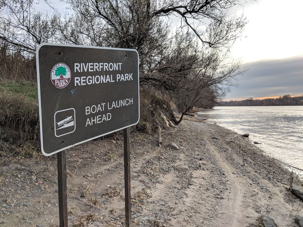
These are some of the challenges faced by Riverfront Regional Park in Fridley. We recently awarded a capital project grant to Anoka County for a project that will stabilize the riverbank and treat polluted stormwater runoff at the park, which contains nearly 7,000 linear feet of Mississippi River shoreline.
Originally developed in the late 1980s, the 139-acre park was left largely untouched until this year, when the county began upgrading it with the help of a $2 million Parks and Trails Legacy grant. The new park will offer improved experiences for its 180,000 annual visitors, but it will also feature some important environmental upgrades.
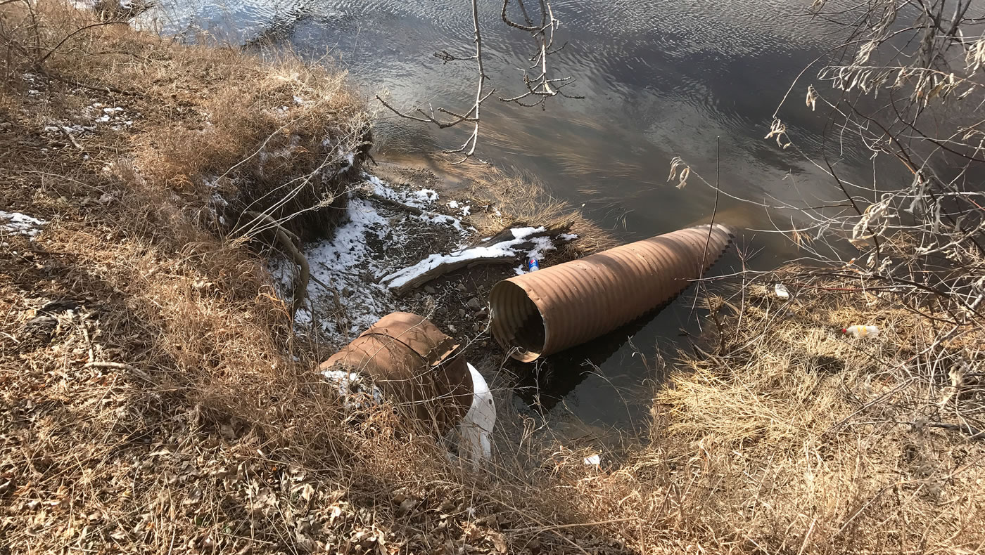
Currently, stormwater runoff at the park’s boat launch sheet-flows over the parking lot into a small turf area with a catch basin. From there, it flows through an underground stormpipe that leads to an outfall on the riverbank below. On top of piping pollution into the river, the pipe and catch basin have degraded with age, causing the river bank to continually erode. In a vicious cycle, the erosion then causes more of the pipe to be exposed and break apart, thus exacerbating and speeding up the erosion process.
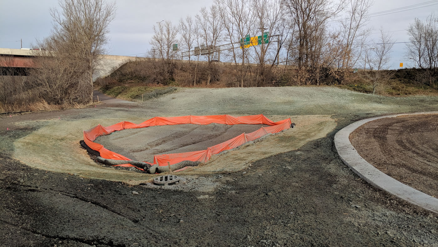
Part of the MWMO grant ($16,200) will fund a new infiltration basin (i.e., rain garden) at the site. The basin is designed to capture the first 2 inches of runoff from the 0.6-acre parking lot and filter it through native plants and engineered soils. These will remove pollutants from the stormwater before it finally makes its way to the river.
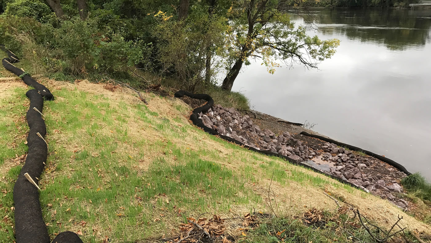
The other part of the grant ($11,920) will pay for stabilization of approximately 1,400 square feet of riverbank to prevent any further erosion. Crews will rebuild the degraded outfall pipe and restore an eroded 1,400-square-foot portion of the river bank. They will accomplish this using a technique called bioengineering. To plan this part of the project, we actually referred back to an old MWMO manual, A Guide to Bank Restoration Options for Large River Systems: Part II Bioengineering Installation Manual (PDF).
Bioengineering for Bank Stabilization
Bioengineering is a common technique used for stabilizing riverbanks, shorelines and ravines with plants. It is an engineered solution that uses natural materials to reinforce slopes. This can be done in several different ways.
One option is to stake dead plant material (brush bundles) into the slopes of the river bank to dissipate the flow of runoff and to accumulate loose sediment. This creates a more gradual slope over time. Another option is cedar tree revetments, which actually re-use trees that need to be removed in order to regrade the slope. The trees are anchored back into the banks, with the roots exposed in the river channel. These roots can become malleable, and actually grow back into the side slope to reinforce the strength of the riverbank. Live stakes, or cuttings of plants and shrubs that like to have their feet wet can also be installed throughout the slope.
When there are extreme cases of slope, scour and shear stress from the river’s flow, riprap, or hard armor, may be used in conjunction with these practices.
For the outfall at Riverfront Regional Park, we are designing to offset flow from both the fluctuating river water levels as well as overflow runoff from the parking lot, which drains towards the river. For these reasons, we chose to use riprap with a mix of soil, erosion control blanket, seed and plants. The riprap will help dissipate flow coming out of the pipe, with a mix of shrubs and native plants/grasses creating an interlocking web of roots to reinforce the slope.
Monitoring for Erosion
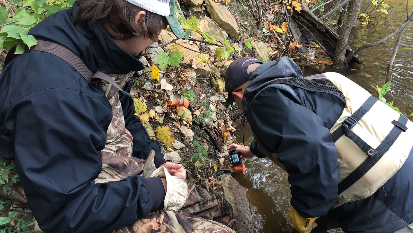
With this established partnership with Anoka County Parks, MWMO will continue to monitor and plan for opportunities to further stabilize and restore the riverbank throughout this area of the watershed. This will include monitoring the erosion of the park’s riverbank over time.
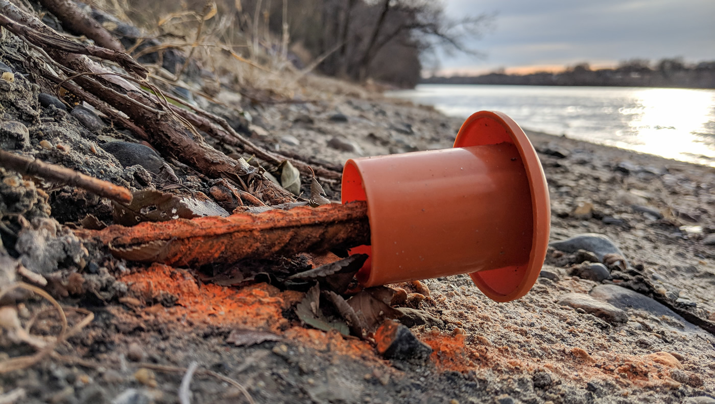
MWMO staff recently installed erosion pins — 3-foot-long pieces of rebar — into the bank along the river’s edge. By monitoring changes to the level of soil relative to the ends of the pins, we will be able to tell how much scour and erosion is occurring over time. This will help us understand erosion at this site, but it could be a case study for how active riverbanks along the Mississippi River are eroding in our watershed.
- Share on:
-
-
-
-
-