
Which surfaces generate the most pollution in downtown Minneapolis?
You can’t stop pollution unless you know where it’s coming from. And in the case of downtown Minneapolis, it could be coming from seemingly anywhere. The city’s dense urban center is almost completely covered in impervious surfaces like streets and buildings. Every rainfall washes pollutants off of those surfaces and out into the Mississippi River, via the city’s stormsewers.
But what if some types of surfaces are more polluted than others? And what if, by knowing which ones are the most polluted, we could target projects to capture and treat the runoff in an efficient, cost-effective way?
That’s the premise of a study we’re conducting with help from the University of Minnesota. Together, we’re running a series of experiments designed to tell us the type and amounts of pollutants coming off of four distinct types of downtown surfaces: streets, sidewalks, parking lots, and rooftops.
The motivation to start this initiative began as part of our watershed modeling project. The MWMO is in the process of creating water quality models for our entire watershed. These models are designed to help us understand and predict the amount of stormwater and pollution that will be generated during storm events. We will use the model results to help plan and target pollution reduction strategies, targeting those areas that are the dirtiest.
One challenge of the water quality model that we’re using is that it treats pollution from all impervious surfaces the same, regardless of type. This technique is sufficient for other areas in the MWMO watershed, where impervious surface are intermixed amongst the pervious; but, in the case of downtown Minneapolis, this approach will result in a kind of “blob” in the data outputs. By gathering more detailed information on pollutant loading from downtown surfaces, we’ll be able to better target pollution mitigation strategies.

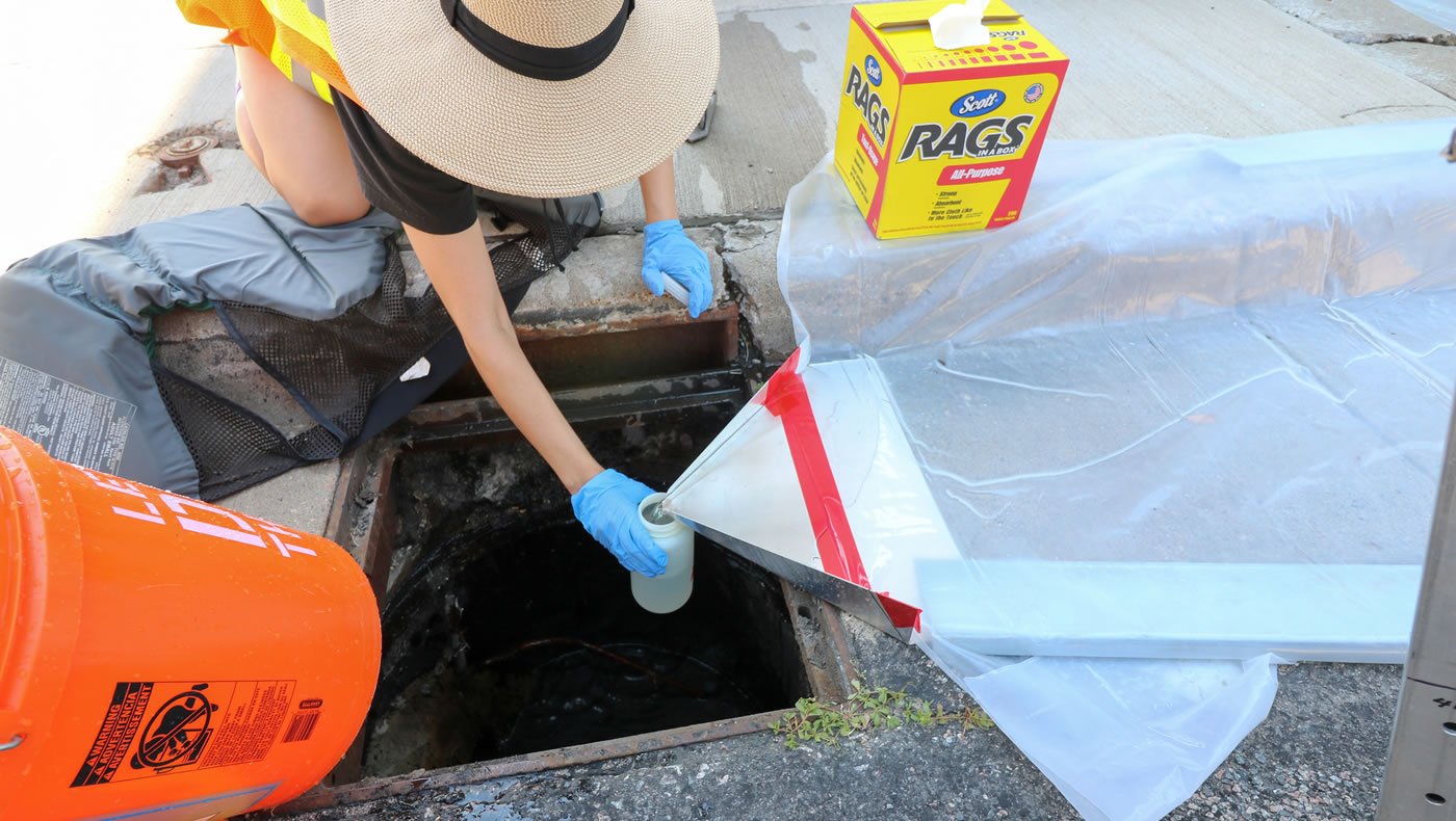
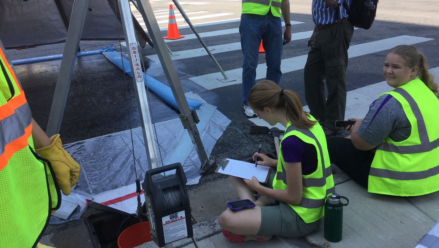
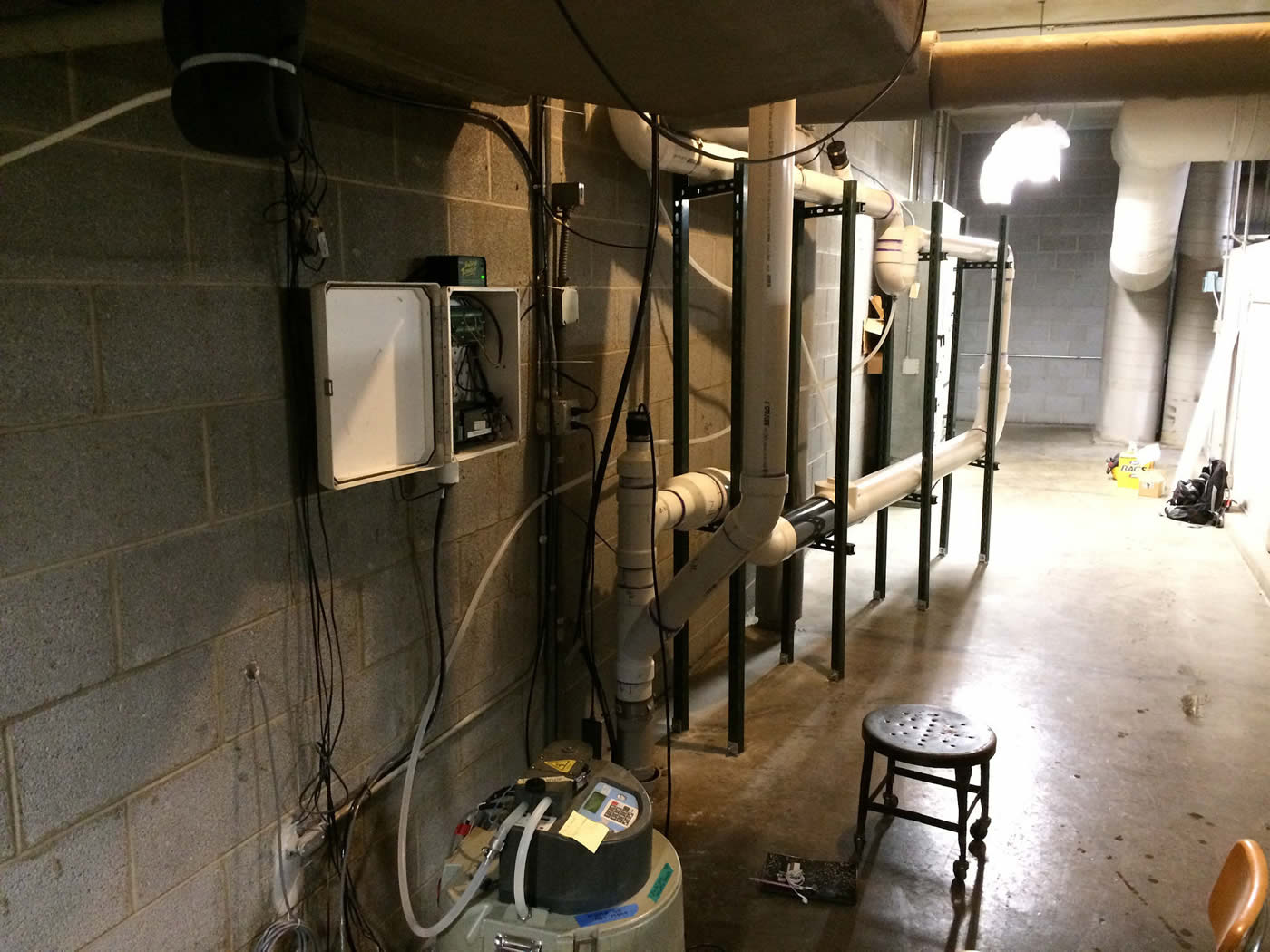
Beginning earlier this year, staff from the MWMO’s water quality monitoring team joined with researchers from the university’s Department of Bioproducts and Biosystems Engineering to collect samples of runoff from strategically chosen locations downtown. The team is analyzing the water quality characteristics of each of the samples, with the goal of determining which types of surfaces are producing the most polluted runoff.
We’re collecting samples from a total of 12 different sites, which includes three of each type of surface targeted by the study. To get a more accurate representation of the runoff characteristics, the team is collecting the data at three different times throughout the year — once each in the summer, fall, and spring. Doing so will allow them to account for seasonal fluctuations in pollutant levels (think leaves in the fall and road salt in the spring).
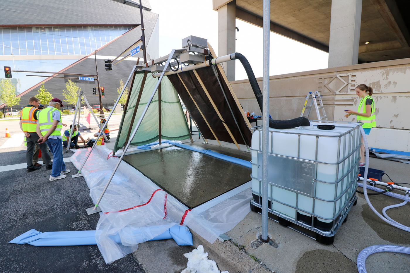
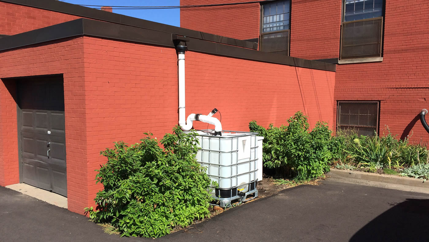
Collecting these samples proved to be a tricky endeavor. In the case of the rooftop sites, the team had to devise a way to capture runoff and divert it so that it could be sampled using automated equipment. Meanwhile, capturing runoff from heavily trafficked streets, sidewalks and parking lots proved to be even more challenging. To ensure their data-collection methods were sound, the team needed to find a way to simulate rain events artificially.
Professor Bruce Wilson had a solution: rain simulators. These special machines are designed to imitate natural rainfall to help researchers study erosion and other stormwater-related issues. The university had already used rain simulators in similar research projects on highway construction. The team was able to borrow a rain simulator from the Minnesota Department of Agriculture for the downtown runoff study. (See the video below.)
Although such studies are not totally unique, one has never been done in Minneapolis. Our study may help confirm national datasets. The MWMO is uniquely positioned to undertake this type of urban stormwater research, and we hope that others will be able to draw lessons from our findings.

- Share on:
-

-

-

-

-